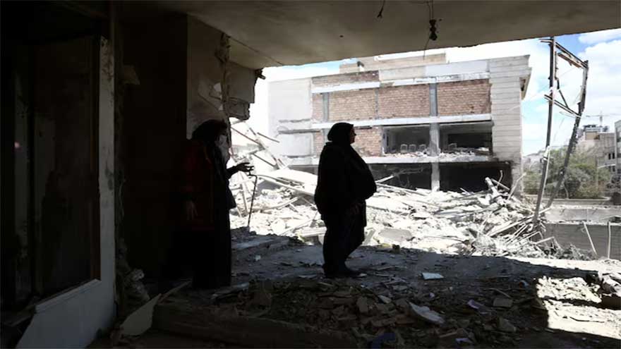
Summary The eruption has caused significant disruptions
(Web Desk) - In a dramatic display of nature's power, the Fagradalsfjall volcano in Iceland sent rivers of molten rock across the icy terrain and satellite overhead has captured the event.
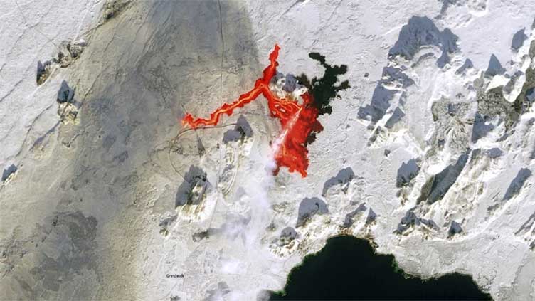
The volcano erupted for the third time since December 2023, painting a stark contrast of fire against ice as captured by the vigilant Copernicus Sentinel-2 satellites.
The eruption has caused significant disruptions, with the lava flow severing the hot water supply to over 20,000 households.
The Civil Protection Agency has been forced to declare an emergency status for the entire Reykjanes Peninsula region, as the community grapples with the consequences of this fiery outburst.
The Sentinel-2 satellite, part of the European Union's Copernicus program, managed to acquire a striking image of the event on February 8, less than ten hours after the eruption commenced.
The photograph shows a plume of smoke and the unmistakable trail of lava near Grindavik, a city known for its proximity to the Blue Lagoon geothermal spa.
This recent activity is part of a series of eruptions that have occurred in the area since March 2021, when Fagradalsfjall ended its 800-year slumber.
Since then, the volcano has become somewhat of a periodic spectacle, with eruptions occurring annually, each carving new paths through the Geldingadalur valley and beyond.
The Copernicus Sentinel satellites are an essential tool for monitoring such natural events, especially in remote regions where ground access may be limited.
They provide crucial data for disaster response teams and researchers, helping to assess the impact of volcanic activity and guide the efforts to protect local communities and infrastructure.