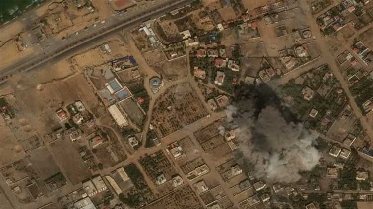
Summary Satellite images show impact of airstrikes on Gaza
NEW YORK (AP) -The destruction and impact from Israeli airstrikes in retaliation for the Oct. 7 attack by Hamas militants is visible in satellite imagery of blocks leveled by missiles and smoke rising over the blast zones — and also in more subtle photos.
Images by Maxar Technologies showed people sheltering in the courtyards at two schools in Gaza City and one in Deir al Balah on Thursday.
A tractor appeared to be overturning fresh soil to make way for new graves as the Marzouq Street cemetery expands in Gaza City.
An overview of Shifa Hospital showed where tents were set up in what used to be a grassy, tree-covered area next to the hospital. Some hospitals have set up tents to treat the wounded and temporarily house the dead.
Along a stretch of road near the beach, a series of round craters marked the spots where airstrikes hit the dirt and didn’t flatten homes.